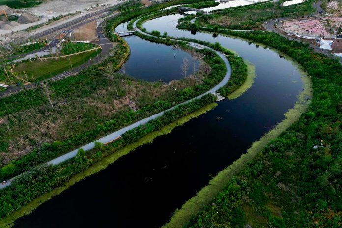
TORONTO: The billion-dollar Port Lands flood prevention project in Toronto has reclaimed a once-polluted industrial area, reconnecting Lake Ontario with the Don River more than a century after they were severed. The initiative, costing Can$1.4 billion (US$1 billion), aims to protect the city from extreme flooding while restoring natural habitats.
Chris Glaisek, chief planning officer at Waterfront Toronto, explained the project seeks to “heal the land from the way it was repurposed 100 years ago,“ focusing on flood protection and ecological restoration. The work included digging a new river valley, creating wetlands, and constructing two river outlets to absorb excess stormwater.
Historically, the Don River’s mouth was the Great Lakes’ largest freshwater marsh, a vital resource for Indigenous communities before industrialization. By the late 19th century, much of the marsh was drained to make way for port facilities, leaving the river polluted and the area underused. “It was really dirty, it was foul, it was terrible,“ recalled Toronto Mayor Olivia Chow.
The urgency for flood protection grew after Hurricane Hazel devastated Toronto in 1954, killing 81 people. Glaisek noted that similar rainfall over the Don River would have caused comparable destruction. Climate change has since reinforced the need for resilient infrastructure.
The project, designed by US-based Michael Van Valkenburgh Associates, not only mitigates flooding but also opens land for housing and recreation. Lead designer Laura Solano said the initiative was “duty bound to address catastrophic flooding” but also offers “much more,“ including parks and waterways for kayaking.
Glaisek emphasized the importance of planning for nature’s unpredictability. “Let’s acknowledge the river is going to flood. Let’s build the space for it,“ he said, referencing recent deadly floods in Texas. – AFP


