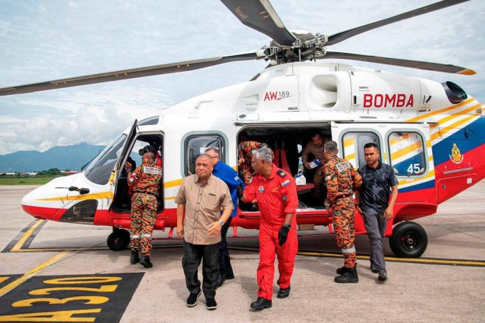
IPOH: Perak Menteri Besar Datuk Seri Saarani Mohamad today conducted an aerial survey of 15 hotspot locations identified as high-risk disaster areas in the state.
The Perak Fire and Rescue Department stated that the surveillance covered areas in Kinta, Changkat Jering and Kinta Kampar facing flood and water surge risks.
Bukit Merah was also surveyed due to its proneness to forest fires and drought conditions.
Saarani additionally monitored the accident-prone Menora Tunnel along the PLUS Expressway and landslide-prone Lenggong.
The aerial operation used the department’s AW189 aircraft from the Air Division departing from Sultan Azlan Shah Airport.
The two-hour flight covered Kinta areas including Ulu Chepor Recreational Park and Kledang Sayung.
Changkat Jering locations included Kampung Bendang Siam and the Bukit Jana Waterfall.
Bukit Merah monitoring encompassed Gunung Semanggol and Tasek Bukit Merah.
Lenggong surveillance covered Kuak Hill Resort and Dataran Tasek Raban.
Kinta Kampar areas included Sungai Siput and Gopeng surroundings.
The inspection was joined by JBPM Air Division director Datuk Norazam Khamis and state officials.
Perak JBPM identified 332 flood-prone hotspots statewide with Kuala Kangsar having the most at 76 locations.
Kinta and Kerian districts each recorded 59 flood-prone locations while Larut, Matang and Selama had 57.
Kinta leads landslide-prone areas with 14 locations followed by Hulu Perak with eight.
Kuala Kangsar has four landslide-prone spots while Kampar has three.
Muallim and Batang Padang districts each have one landslide-prone location.
Kinta recorded eight water surge-prone locations followed by LMS with four.
Hulu Perak, Kampar and Kuala Kangsar each have three water surge-prone areas.
Kerian leads forest fire-prone locations with seven followed by Hulu Perak with five.
Perak Tengah, Manjung and LMS each have two forest fire-prone locations.
Bagan Datuk, Kuala Kangsar and Kinta each have one forest fire-prone area. – Bernama


