KOTA BHARU: Known for its rugged terrain and frequent elephant crossings, the East-West Highway (JRTB) connecting Gerik in Perak to Jeli in Kelantan is considered one of the most challenging routes in Peninsular Malaysia.
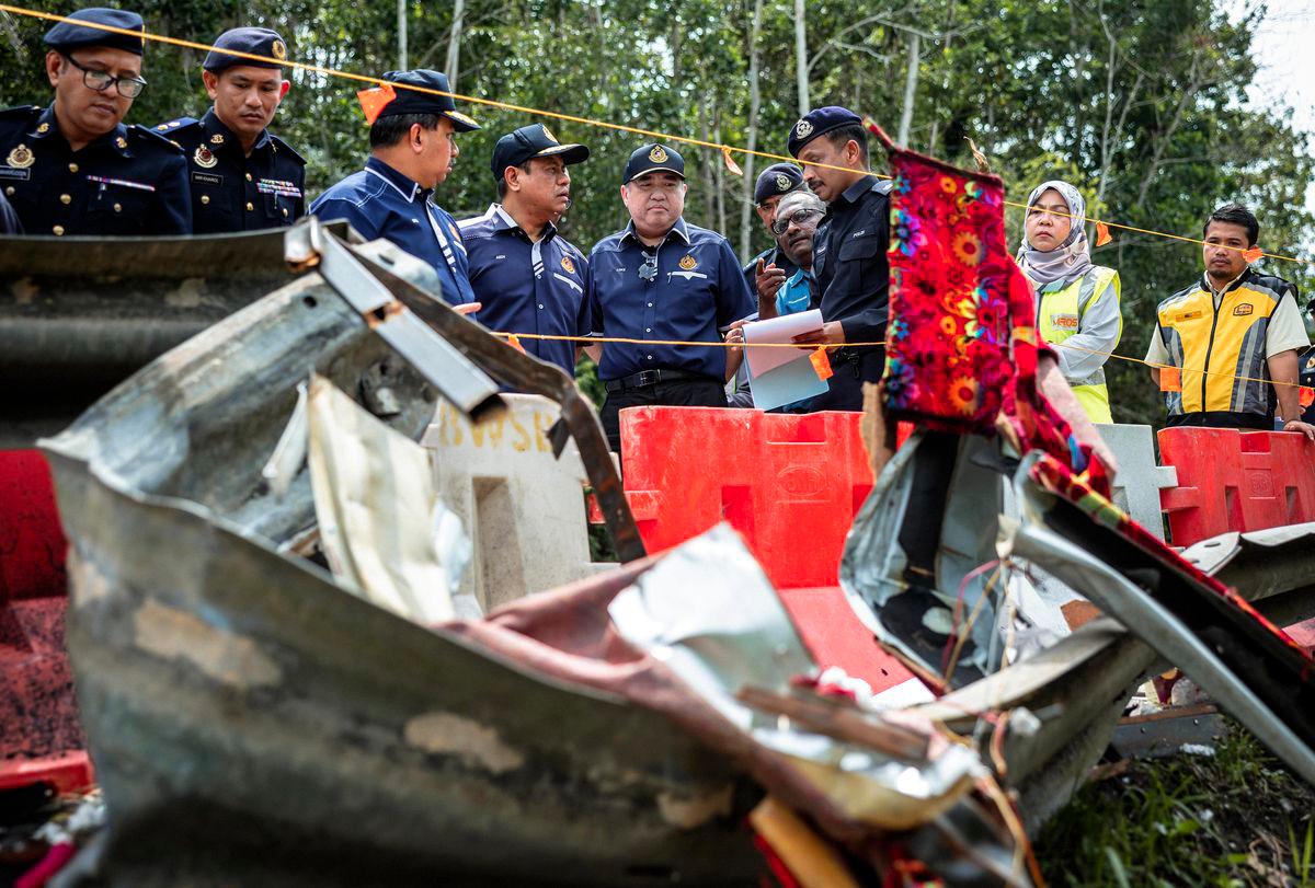
Every year, fatal accidents are reported along this route, but the tragedy that occurred in the early hours of Monday, June 9, was the worst ever recorded on JRTB. It claimed the lives of 15 students from Universiti Perguruan Sultan Idris (UPSI), who were on their way back to campus in Tanjung Malim, Perak, after celebrating Aidiladha with their families in Jerteh, Terengganu.
The tour bus, specially chartered by a group of 42 UPSI students, was involved in the horrific crash around 1 am near Tasik Banding, Gerik— just a few hours after they had departed from the grounds of Masjid Hadhari in Jerteh, where they had gathered before beginning their journey back to campus.
This writer, based at Bernama’s Kota Bharu bureau in Kelantan, was assigned to cover the tragedy, with Gerik Hospital as the destination.
THICK FOG
Although it was not the writer’s first time driving on JRTB, anxiety loomed before departing from the town of Jeli, especially since the route had just claimed 15 lives. Past experiences reminded the writer how challenging the highway can be, especially for those unfamiliar with it.
Thick fog still blanketed the road as the writer began the drive to Gerik at 6 am on Monday, June 9, slowly leaving Jeli and entering JRTB.
Just a few kilometres out of town, the road’s condition began to show. At one bend, the writer almost lost control of the vehicle due to uneven road patchwork, with the front tyre hitting hard and causing the heart to skip a beat.
The road wasn’t just undulating—it was riddled with potholes, some deep enough to trap a vehicle’s tyre. Even worse, sharp corners appeared suddenly without warning signs. In several places, the road was extremely narrow—barely enough to pass oncoming traffic—and pitch dark due to the lack of streetlights.
At the same time, it’s undeniable that JRTB, which cuts through the Titiwangsa and Bintang mountain ranges, offers breathtaking views of lush rainforests along its 120-kilometre stretch.
However, behind the thick foliage lining both sides of the road, deep ravines await the careless. Not to mention the “surprises” from wildlife—such as monkeys and wild boars—that sometimes dart across suddenly, risking accidents.
FULL CONCENTRATION
Though not halfway into the journey yet, the tension from constant focus on the drive led the writer to stop for a 30-minute break at the Titiwangsa Rest & Recreation (R&R) area.
In fact, the JRTB is not the only route connecting the east coast, west coast, and northern regions of Peninsular Malaysia. Motorists can also opt to use the Simpang Pulai-Gua Musang route; however, due to its longer distance, most travellers heading to Kelantan or from Kelantan to the west coast or north prefer the JRTB.
“This road (JRTB) is quite dangerous, but it’s the only one I use to visit my wife’s hometown in Machang, Kelantan. I usually depart in the morning so it’s bright and I can avoid potholes and sharp turns more easily,” shared Ahmad Fauzan Ismail, 35, whom the writer met at the rest area.
Ahmad, a private-sector employee from Sungai Petani, Kedah, said he prefers JRTB as it avoids a longer, roundabout journey compared to the Simpang Pulai-Gua Musang route.
Retired civil servant Wan Mokhtar Wan Ismail, 63, a frequent JRTB user, added that although he’s familiar with the route, the road’s unpredictable condition makes it impossible to anticipate what lies ahead.
“There’s always fear whenever I drive on JRTB because we don’t know if there’s road damage or potholes ahead—or wild elephants, even.
“I’ve lost count of how many times my tyres have hit potholes on this road. Some you can see coming because the surface is uneven or patched, but others you can’t avoid in time... you just accept it,” said the man, who was on his way to Baling, Kedah.
HISTORY OF JRTB
Many may not know the history of JRTB, but based on accounts from Kelantan elders and sources like Wikipedia and the Ministry of Works, the road was built through the blood and sweat of Public Works Department (JKR) staff, starting in 1967 and officially opened on July 1, 1982.
Covering 123 km at a cost of RM205 million (then), the project was inspired by the first Prime Minister, the late Tunku Abdul Rahman Putra Al-Haj, and was one of the largest highway projects fully undertaken by JKR.
Before the road’s construction, the journey from Kota Bharu to Alor Setar was around 1,000 km.
JRTB’s development was a strategic government move to curb communist threats by developing rural areas. Throughout its construction, the military secured every kilometre to prevent attacks and block communist forces from crossing into Thailand.
JKR staff and security personnel were constantly exposed to danger. Malaysia’s history recorded several ambushes, including the Aug 27, 1974 incident that killed three JKR personnel. Earlier that year, on May 23, communists blew up 63 JKR machines.
To commemorate these events, the Ministry of Works erected a memorial in 1994, which was upgraded in 2015 and officiated by then-Works Minister Datuk Seri Fadillah Yusof. The monument stands at the original ambush site of May 23, 1974.
From its opening in 1982, JRTB was placed under the control of the Territorial Army Regiment due to ongoing communist threats. At the time, the road could only be used during daylight. Military control was only withdrawn after the threat ended with the signing of the Hat Yai Peace Agreement on Dec 2, 1989.
The project continued with Phase Two involving the Kulim-Baling and Titi Karangan-Gerik routes, developed between 1993 and 2005.
However, unlike Phase Two, Phase One of JRTB seems to have been “forgotten,” as the writer observed that the road has not been maintained as it should be.
This was acknowledged by a military veteran who was involved in the construction of the JRTB. According to Jamaludin Mohd Amin, 69, he was assigned to ensure the safety of workers building the highway back in 1977.
“If I were to compare the road conditions then and now, there’s not much difference,” he said when met by the writer while visiting the tour bus that carried the UPSI students, at the Gerik District Police Headquarters.
RISK OF REPEATED TRAGEDIES AND CALLS TO AUTHORITIES
The UPSI student tragedy clearly caught the authorities’ attention after social media users pointed out that white lane markings—absent before the June 9 accident—suddenly appeared at the crash site.
The writer’s observation during the drive found that many places had faded or nearly invisible white lines dividing opposing lanes, even in daylight. Imagine the conditions at night, with no streetlights.
“My only advice when using this road is to drive slowly and carefully, especially in areas marked with wildlife or sharp curve warnings,” said truck driver Rosmadi Ab Manaf, 49, another JRTB user.
“Don’t be overconfident even if you’re familiar with the route—disaster can strike without warning,” added Rosmadi, who often transports fruits from Penang to Kelantan.
However, it was Siti Aminah Awang’s words that left the writer speechless:
“I wonder how long it took for rescue teams to reach the accident site on such a winding and dangerous road?” said the 28-year-old woman.
After nearly three hours of driving, the writer finally arrived safely at the destination. The assignment awaiting at Gerik Hospital was truly heart-wrenching, but the journey along JRTB opened the writer’s eyes to the urgent need for improvements to a road that is now nearly 43 years old.


