KUALA LUMPUR, Aug 24 (Bernama) -- Kuala Lumpur City Hall (DBKL), along with the relevant agencies and utility companies, are advised to collaborate in mapping underground utilities to avoid unwanted incidents, especially when a development project is underway.
Communications Minister Fahmi Fadzil said that mapping utilities is crucial to understanding the underground situation, as many areas contain pipelines and electric cables that are sometimes not accurately mapped by utility companies.
“I have received many complaints I have received many complaints that during the development of projects, dredging work often reveals large TNB cables, for example, that were not indicated on the map.
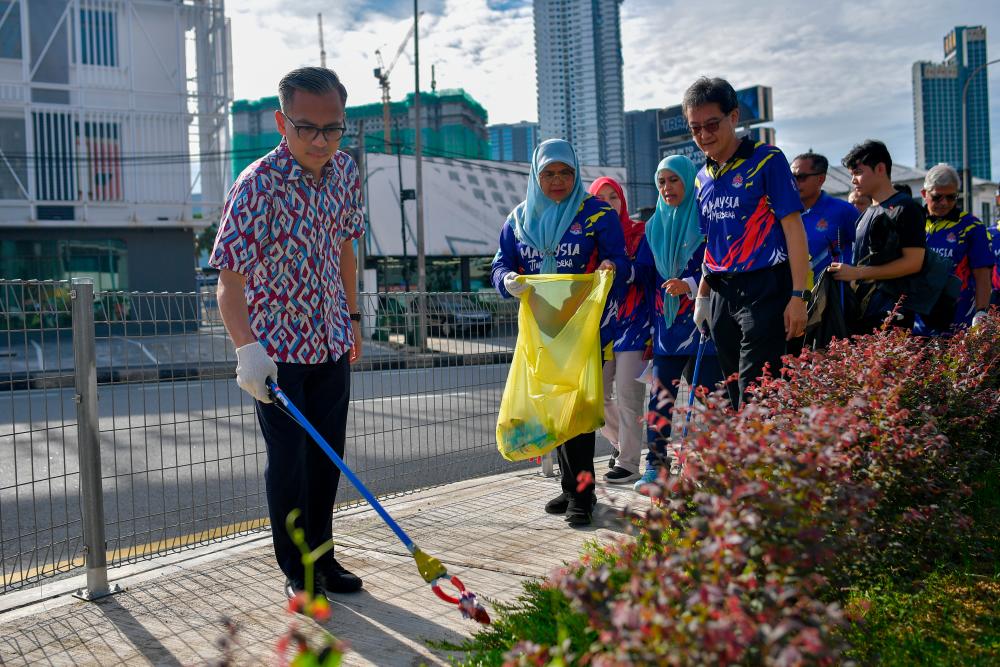
“Hence, a need for collaboration with the Kuala Lumpur mayor to ensure that we not only have mapping on the surface but also utility mapping,“ he told reporters when met after the Kuala Lumpur Federal Territory Mega Merdeka Gotong-royong programme today.
The programme was opened by Kuala Lumpur Mayor Datuk Dr Seri Maimunah Mohd Sharif.
The gotong-royong programme is carried out simultaneously in 11 parliamentary constituencies in the Federal Territory of Kuala Lumpur for the first time in conjunction with the upcoming 2024 National Day celebration.
Meanwhile, Maimunah said she will hold a meeting with the relevant agencies that have underground utilities to discuss utility mapping to avoid untoward incidents, including the one that happened at Masjid India yesterday.
“We already have the GIS (Geographic Information Systems). We also need to have a mapping not only by utility companies but also mapping in terms of DBKL facilities, for example, the open areas, that have been gazetted, areas vandalised and those that need to be upgraded,“ he said.
In the incident at 8.20 am yesterday, an Indian national woman, Jayaletchumy, 48, fell into an eight-metre-deep sinkhole after the ground gave way when she was walking in the area in front of Malayan Mansion at 8.22 am.
According to Maimunah, DBKL has mapped 35 flood hotspot locations in the federal capital.
“Previously there were only 21 flood hotspots and due to the change in weather, 14 more hotspots have been identified,“ she said.


