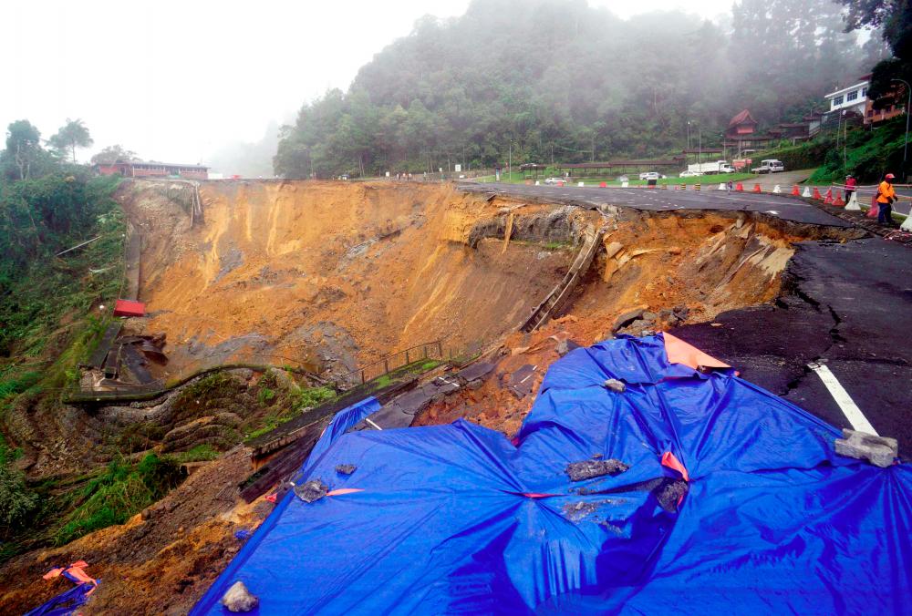
PETALING JAYA: The Works Ministry has listed Pahang, Perak, Kelantan and Selangor as the four states in Peninsular Malaysia with the most hotspots for slope failure and most likely to experience landslides.
The “Slope Hazard and Risk Map” developed in 2020 by the Public Works Department (PWD) Slope Engineering Branch (SEB) indicates 1,045 very high-risk slopes and 976 high risk slopes along federal roads that are being monitored closely during the monsoon season.
Some of the hotspots are FT4 Lebuhraya Timur-Barat, FT6 main road that circles the Penang island, FT8 Jalan Bentong-Gua Musang-Kuala Krai, FT36 Jalan Aring 8-Kenyir-Kuala Jeneris, FT55 Jalan Kuala Kubu Baru-Gap-Tranum, FT56 Jalan Gap-Bukit Fraser, FT59 Jalan Tapah-Cameron Highlands, FT68 Jalan Kuala Lumpur-Bentong (Jalan Bentong Lama), FT86 Jalan Seremban-Kuala Klawang-Simpang Pertang, FT102 Jalan Pos Betau-Lembah Bertam, FT148 Jalan Baru Gap-Fraser’s Hill, FT185 Jalan Simpang Pulai-Blue Valley-Lojing-Gua Musang and FT220 Jalan Bayan Lepas-Pekan Air Hitam.
Works Minister Datuk Seri Alexander Nanta Linggi said during the monsoon season, the frequency of inspections and patrols along federal roads and slopes have been increased, especially on hazardous and high-risk slope locations.
“This is done to ensure the drainage system is working well and not clogged, which could hinder water flow, cause flooding and contribute to slope failure.
“PWD is prepared around-the-clock to mobilise in the event of slope failure or other (hazards), to ensure all (vital) points are secured and appropriate precautions such as warning signs and traffic management plans for road users are taken,” he told theSun.
Nanta also said the ministry has increased the frequency of patrols at the hotspots, especially during the rainy season.
He added that monitoring would be conducted visually, such as going on-site and doing detailed inspections of the condition of structures and components on slopes.
To ensure smooth traffic in landslide-prone areas, he said PWD would put up traffic management signs, create detours and if necessary, close the road and notify the public of alternative routes through social media.
He said the ministry will identify slopes that need to be strengthened according to priority, based on the Slope Hazard and Risk Map, and carry out repairs, prevention and maintenance works, adding that the ministry was working with the community and local authorities to create an awareness programme on the dangers of landslides.
“The programme includes putting up advertisements on landslide hazard awareness in local newspapers in Malay, English, Mandarin and Tamil as well as uploading the information on the PWD and SEB social media accounts.”
He said in ensuring that every department works seamlessly, the ministry will be distributing Slope Hazard and Risk Map data to the National Disaster Management Agency and local authorities.
Nanta added that among measures taken to address landslide issues, the ministry was monitoring soil movement through the PWD landslide Early Warning System (EWS), which involves installation of instruments at slopes that have been categorised as a hotspot.
“EWS also involves using Robotic Total Stations (RTS) that measures rainfall intensity as a landslide early warning (indicator). Slope surface movement data provided by RTS will be then sent to the EWS for analysis and will be displayed on the EWS website and monitored by PWD. If the soil movement and rainfall intensity exceed the threshold limit, the EWS will be triggered and it will notify the supervising PWD personnel to take precautionary measures and conduct an on-site inspection to identify any signs of slope failure,” he said.


